
Why PWC Sea Condition Ratings Matter for Rider Safety
Sea-condition ratings matter because they tell you, before you ever launch, whether your craft, your skill level, and your planned route can handle what the water is actually doing that day. A rating consolidates wind speed, wave height, swell period, and current into a single operational risk snapshot. That matters more on a PWC than on almost any other vessel: a forecasted “seas 3 to 4 feet” can hide individual waves running 1.5 to 2 times higher than the average, and a 21-foot boat shrugs that off in a way a 700-pound jet ski cannot.
Key Takeaways
Sea-condition ratings work because they convert wind, wave height, swell period, and current into a single risk estimate riders can match against skill level before launch.
| Point | Details |
|---|---|
| Ratings combine multiple inputs | Wind, significant wave height, swell period, visibility, and current all shape actual risk. |
| Averages hide spikes | Individual waves can run 1.5 to 2 times higher than the posted significant wave height. |
| Cross-check live data | Confirm NWS forecasts against nearby NDBC buoy readings before and during a ride. |
| Match thresholds to skill | Beginners, intermediate riders, and advanced racers need different go/no-go limits. |
| Act early on warning signs | Wind shifts, opposing currents, and building whitecaps call for an immediate return to shore. |
Where to Check Conditions Before You Launch
- NWS marine forecasts for zone-by-zone wind, seas, swell, and active warnings.
- NDBC buoy observations for real-time conditions near your launch point.
- Marine radar apps for tracking incoming weather cells in real time.
- Local tide tables to time current windows against your ride plan.
Table of Contents
- What a Sea Condition Rating Actually Measures
- How Wind, Waves, Swell, and Currents Change PWC Handling
- How to Use Ratings to Plan Your Ride
- Watching Conditions on the Water and Knowing When to Turn Back
- A One-Page Pre-Ride Checklist for PWC Riders
- Common Misconceptions About Sea Condition Ratings
- Ready to Match Your PWC to Rougher Water?
- What Actually Matters Most in Sea Condition Ratings
- Frequently Asked Questions
- Sources
What a Sea Condition Rating Actually Measures
A rating isn’t one number. It’s a blend of five inputs, and understanding each one changes how you read a forecast before you trailer the PWC anywhere.
- Wind speed and direction — the primary driver behind wave buildup and the fastest-changing variable on the water.
- Significant wave height (“seas”) — the average height of the largest one-third of waves, not the tallest wave you’ll actually see.
- Swell height and period — how much energy is moving through the water and how far apart the waves arrive, measured in seconds.
- Visibility — fog, haze, or glare that shortens your reaction window to other traffic or obstacles.
- Current and tide interaction — how moving water changes wave steepness independent of wind.
The National Weather Service’s sea state guidance still relies on Beaufort-based visual observation for a reason: instruments aren’t always available, and a trained eye reading whitecap coverage and wave crest behavior can estimate conditions almost as reliably as a buoy reading.
Pro Tip: If your PWC has no onboard weather display, watch the horizon for whitecap frequency. Scattered whitecaps generally track to Beaufort force 4 (11 to 16 knots); widespread whitecaps with spray mean you’re already past comfortable PWC range for most riders.
How Wind, Waves, Swell, and Currents Change PWC Handling
Forecast numbers translate directly into what your hands and body feel on the water, and the translation isn’t linear. Short-period wind chop, the kind generated by local gusts over a few miles of fetch, hits a PWC hull in fast, steep pulses that punish your wrists and lower back. Long-period ocean swell, even at the same reported height, lifts and rolls the craft more gently and gives you time to adjust trim.
- A beginner on a rented 110hp PWC nearshore starts losing confident control once seas exceed roughly 1 to 2 feet with any wind chop layered on top.
- An experienced racer running an offshore lap can manage 3 to 4 foot seas with a long swell period, but the same racer gets punished by short, breaking 2-footers stacked close together.
- Fatigue compounds fast: constant micro-corrections to stay upright in chop burn forearm and core strength far quicker than steady cruising, and seasickness risk climbs with irregular, confused seas.
- Reduced visibility from spray or fog cuts your reaction time to other watercraft, buoys, and shoreline hazards.
The reported significant wave height is only an average. Individual waves in that same wave field can run 1.5 to 2 times higher than what’s posted, which means a “calm-sounding” 2-foot forecast can deliver an occasional 3.5 to 4 foot wave that catches an inattentive rider off guard. Opposing currents and wind can also stack wave height and whitecap formation quickly, turning a moderate afternoon into a rough one within an hour.
How to Use Ratings to Plan Your Ride
Turning forecast data into a launch decision comes down to checking the right sources and applying consistent thresholds instead of guessing from the shoreline. The NWS marine forecast portal gives you zone-by-zone wind, seas, swell, and visibility, along with any small craft advisories that override routine planning. Cross-check that forecast against NDBC buoy observations near your launch point. Forecasts lag reality, and a nearby buoy tells you what’s happening right now, not six hours ago.
Wind thresholds are a useful shorthand once you know them. Small craft advisories typically escalate around key wind thresholds commonly used to define warning levels (https://primonautic.com/blog/marine-weather-forecast-reading-sea-conditions-explained), and those breakpoints work reasonably well for PWC decision-making too, adjusted down for rider skill.
| Rider Skill | Wind Guidance | Significant Wave Height | Swell Period Note |
|---|---|---|---|
| Beginner | Under 10 knots | Under 1 foot | Any period; avoid mixed chop |
| Intermediate | Up to 15 knots | Up to 2 feet | long period preferred |
| Advanced/Racer | Up to 20 to 25 knots | Up to 3 to 4 feet | Comfortable with 6+ seconds |
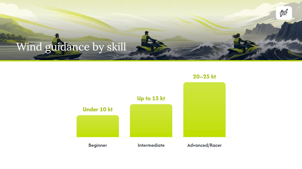
Run this workflow before every launch: check the NWS zone forecast, confirm it against the nearest live buoy, note the current tide stage and whether current opposes wind, match the numbers to your skill band above, and only then commit to a route.
Watching Conditions on the Water and Knowing When to Turn Back
Forecasts describe averages. What actually threatens a ride is a sudden shift the forecast didn’t fully capture. Watch for a rapid change in wind direction, current running against wind (which steepens waves fast), a jump in whitecap density, dropping visibility, or a new swell train arriving from a different angle than the wind sea.
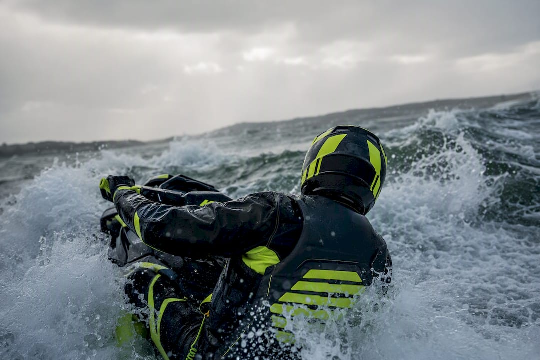
When any of these show up, act immediately rather than waiting to see if it passes. Slow down, change heading to find a lee shore or wind shadow, and start working toward the nearest safe landing point. Keep a VHF radio or charged phone accessible, and always have a float plan on file with someone onshore before you leave.
Pro Tip: Build a rolling mental model as you ride: compare what you see every 10 to 15 minutes against your launch-time forecast. If two or more indicators (wind, wave steepness, visibility) have moved against you at the same time, that’s your cue to head in, not push further out.
A One-Page Pre-Ride Checklist for PWC Riders
Print this, screenshot it, or keep it on your phone. Run through it every single time, even on familiar water.
- Check the NWS marine zone forecast for wind, seas, swell, and active warnings.
- Confirm the nearest NDBC buoy reading matches the forecast within reason.
- Check tide tables and note whether current will oppose or align with wind during your ride window.
- Rate your own skill honestly against the go/no-go table and pick a route accordingly.
- Confirm safety gear: life vest, kill switch lanyard, whistle, and communication device.
- File a float plan with a specific return time and location.
For coastal launches specifically, IPD Racing’s jet ski coastal riding safety prep guide expands on tide timing and shoreline hazards, and the open water safety gear guide covers what belongs in your kit before you ever leave the dock.
Common Misconceptions About Sea Condition Ratings
The most common mistake riders make is checking a land weather app instead of a marine forecast. Land forecasts don’t account for wave height, swell period, or marine-specific advisories, and the wind reading at an inland airport rarely matches what’s happening two miles offshore.
The second mistake is underestimating current. A tide window that looks calm on the surface can be moving fast enough to steepen waves dramatically when it runs against wind direction, an effect that catches riders off guard near inlets and passes. A third: mistaking calm-looking water near shore for calm conditions overall, when local wind chop and incoming swell from a distant system are two separate things that stack on top of each other.
Pro Tip: Advanced riders pushing offshore limits should build in a wider buffer than the basic thresholds suggest. Since individual waves can spike 1.5 to 2 times above the significant wave height, treat any forecast near your personal ceiling as if it’s already at that ceiling.
Ready to Match Your PWC to Rougher Water?
Reading the ratings correctly is half the equation. The other half is making sure your craft is actually tuned to handle the conditions you’re comfortable riding in. IPD Racing’s guide on watercraft tuning best practices for racers walks through setup adjustments that improve handling in chop and swell, and the full performance parts shop carries the hull, steering, and handling upgrades that make a real difference once seas start building past beginner thresholds. For riders weighing hull response in rougher water, IPD Racing’s breakdown of why PWC hull rocker matters is worth reading before your next upgrade decision. If you’re also managing risk beyond the ride itself, Diamondback Insurance’s guide to boat insurance and tow services covers what a contingency plan should include if conditions turn faster than expected.
What Actually Matters Most in Sea Condition Ratings
Most PWC safety content treats wind speed as the only number worth watching. That’s incomplete. Swell period changes the entire character of a ride at the same reported wave height, and it gets buried in guides that focus purely on knots. A 3-foot sea with a 12-second period rides completely differently than a 3-foot sea with a 6-second period, and riders who only check wind miss that distinction every time.
The bigger gap in conventional advice is treating significant wave height as a ceiling instead of an average. It’s an average of the top third of waves, which means the water will occasionally throw something meaningfully larger at you, and riders who plan right up to the posted number leave themselves no margin.
If you take one thing from this: build your skill-based thresholds with that variance already priced in, not as an afterthought. Check the forecast, cross-check the nearest buoy, and treat any number close to your limit as if it’s already past it.
Frequently Asked Questions
Why do PWC riders need marine forecasts instead of regular weather apps?
Standard weather apps report land conditions and skip wave height, swell period, and marine advisories entirely. The NWS marine forecast is built specifically for water-based decisions.
What wind speed is too much for a PWC?
It depends on skill level, but beginners should stay under 10 knots, intermediate riders can handle up to 15 knots, and advanced riders can often manage 20 to 25 knots if swell period is favorable.
Why does significant wave height matter more than it sounds?
It’s an average of the largest third of waves, so individual waves can run up to twice that height. A 2-foot forecast can still produce a 4-foot wave.
How often should I check buoy data during a ride?
Check before launch and again every 30 to 60 minutes if conditions seem to be shifting, since forecasts lag real-time buoy readings.
Does current really affect wave height that much?
Yes. Wind blowing against a strong current steepens waves noticeably, especially near inlets and passes, even when the wind speed alone would suggest calm conditions.
Sources
- NWS Marine Forecasts
- NDBC observations overview
- Significant wave height explanation — National Weather Service

